astradal
maps, territories and data
The digital revolution is shaking up cities and territories, even in the way they are mapped. astradal responds with an innovative digital and cartographic solution, centered on data.

Discover the DNA of astradal

For a new cartography of territories and their infrastructures
The Internet is shaking up the city and digital is transforming territories. Now, how to map them?
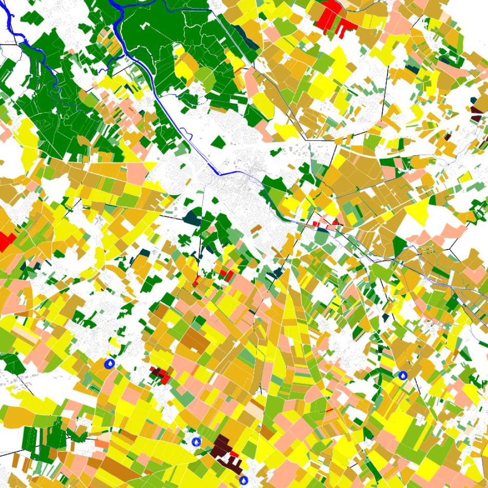
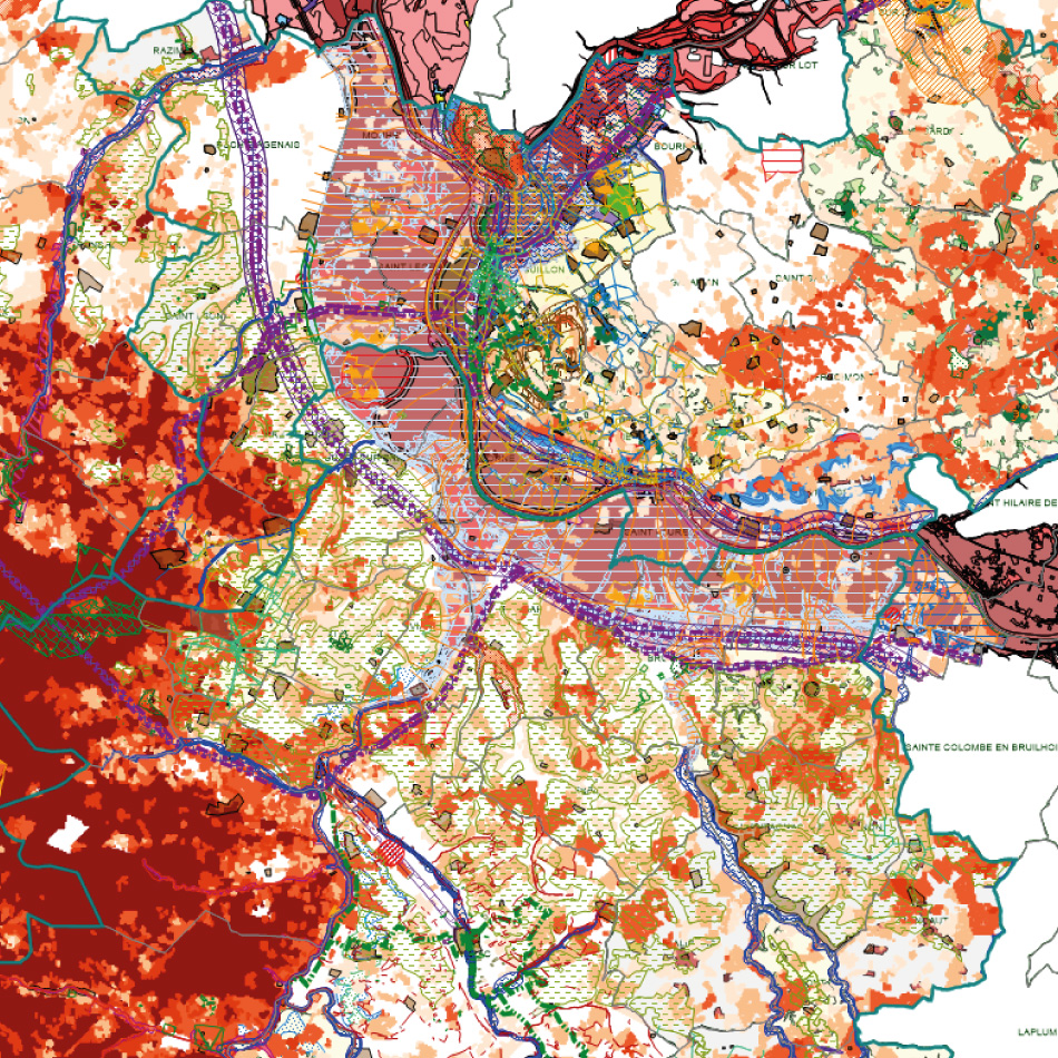
Equipment, infrastructure, amenities: nothing that constitutes the city and the territories can escape the inflation of information, the inflation of data
But if data accumulates, partly under the action of new (connected) objects and innovative tools (such as satellites ), these data also show the reality of space in its complexity and make its management all his interest.
In this new era full of challenges, the map thus becomes the object that unites the data, the solution that organizes them and the instrument that simplifies their use in a totally full-web environment.
Mapping your data has never allowed you to better understand it. It is all the space science that we put at the service of the knowledge of your environment and territories .
Oversee
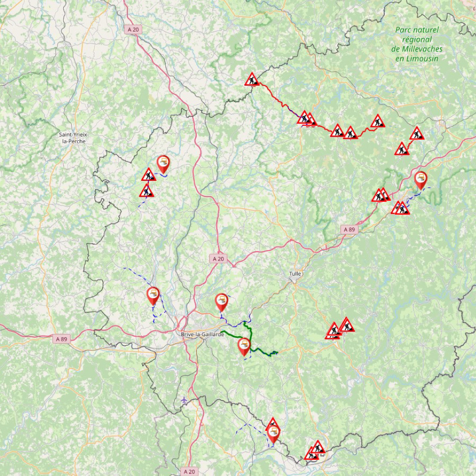
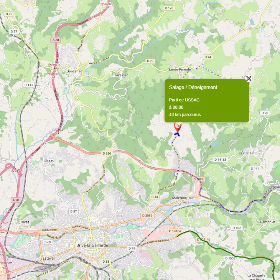
Monitor, follow and control in real time the data of the territory to reinforce its knowledge
To plan
Analyze the data to plan interventions on the equipment and infrastructures of the territory
Decide
Master the functioning of the territory and its infrastructures to make the relevant decisions
Share
Organize data and structure it to allow mobility in the field

Comprehensive tools for your analyzes and decisions
astradal, a panel of cartographic applications and decision support tools
Store data, enrich it to build maps: astradal transforms your data to monitor your equipment, solve problems, analyze trends and share them.
Accessing the astradal platform means entering a technological environment dedicated to strategic geodecision and offering applications that provide users with experiences perfectly suited to their needs.
Thus, astradal has structured a ready-to-use content platform for daily use. This complete offer is aimed at all areas of land and city management: water, smart grid, energy distribution, roads, mobility, infrastructure, land and connected agriculture.
From integration to analysis and data visualization, astradal offers a complete and multi-business experience to discover the potential of your data from the cloud .

A set of web applications for a variety of actors and customers
astradal, a universe of web applications dedicated to local authorities as well as to private actors of territory management
astradal responds to all players who massively use spatial data and demonstrate a strong need for visualization. Each type of industry and each level of local authority are now concerned by these geographical fields of application.
The inflation of geodata is accelerating this phenomenon and making it essential to master this area of knowledge: the 25% growth of connected objects (IoT) per year offers a volume of data so large that it improves the accuracy of the processes of decision.
Lighting networks, water distribution, smart grids, public transport, mobility, energy management, connected agriculture, ports and airports, urban planning…: all areas of a territory are concerned and are now investing in spatial analyzes with a strong movement of private actors who are joining public actors who have hitherto been at the forefront of these resources.
Private actors now consider, in the same way as local authorities, the interest of geographic tools as a sustainable alternative for the management of assets and infrastructures thanks to their functionality, their flexibility and their adaptability both existing systems and the latest equipment.
astradal in an ecosystem of partners
Collaborative and innovative projects
astradal sees itself as a young innovative company evolving in a broader movement that brings together startups, ETIs, key accounts, decision-makers and also investors or local authorities.
Thought of as a whole, astradal has therefore chosen to invest in competitiveness clusters that bring together companies of all sizes, research players and training establishments in order to develop synergies and cooperation around sectors of specific activity.
In the case of its commitment, competitiveness clusters have been selected. astradal has thus approached Tenerrdis in order to strengthen its know-how and its partnerships in the field of energy distribution and Mov’éo to deepen its experience in mobility.
astradal is also involved with Systématic to work with partners on the management of territories and connected objects, with Aqua-Valley for all issues related to water, irrigation and sanitation and finally with the Avenia cluster to deal with geoscience and land issues.
As an innovative player, astradal is also a member of French Tech Toulouse as well as French Proptech.
Solutions offered by astradal technology
Our business: publisher of cartographic software in SAAS solution
A geospatial management and analysis platform
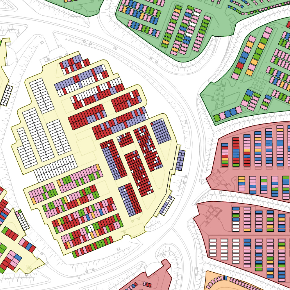
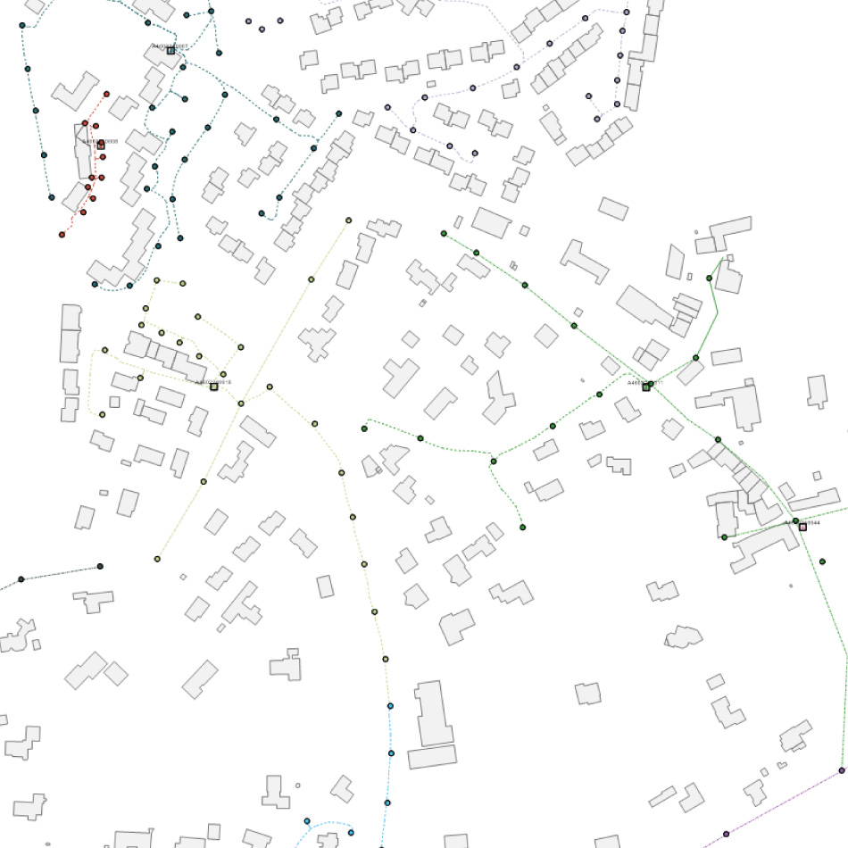
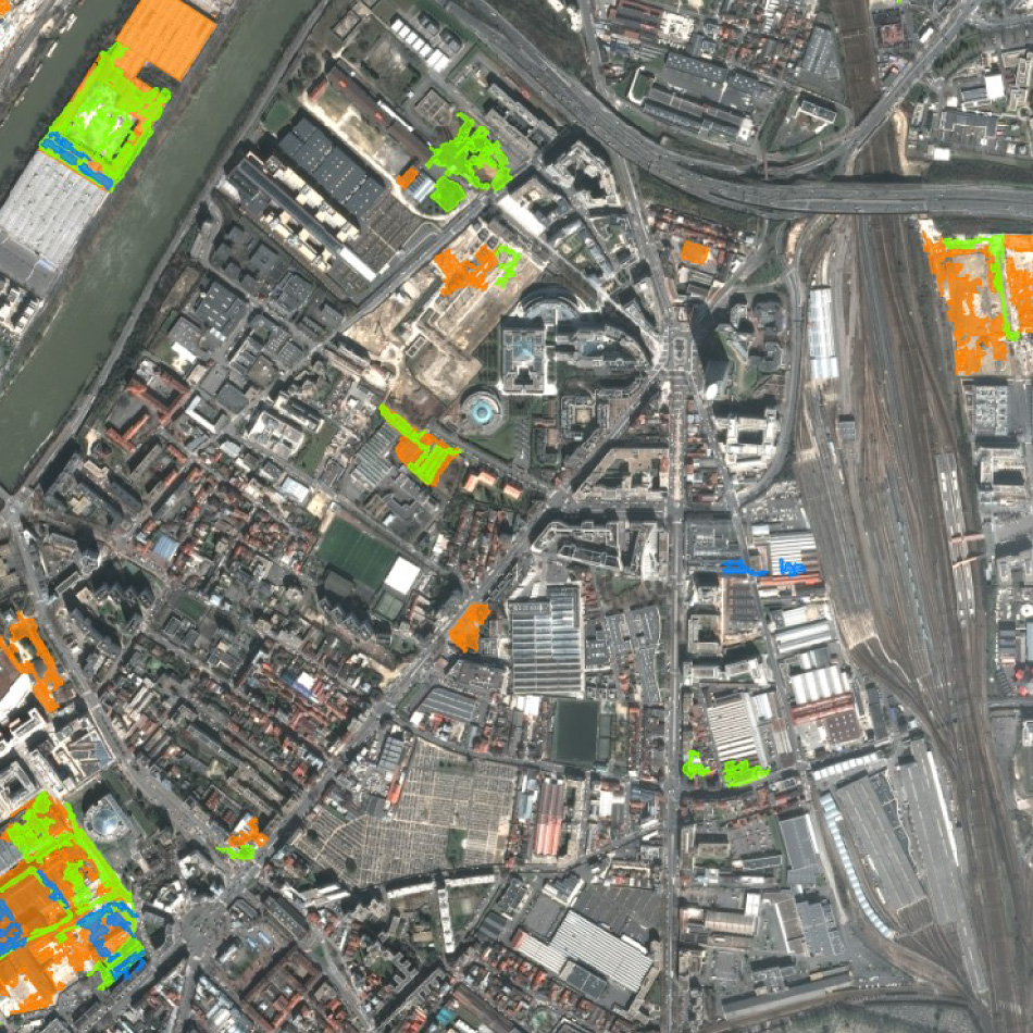
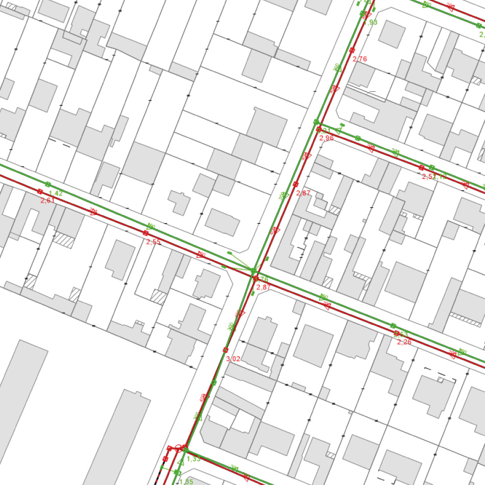
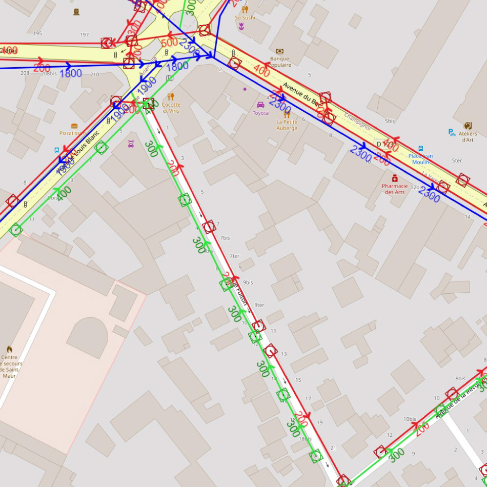
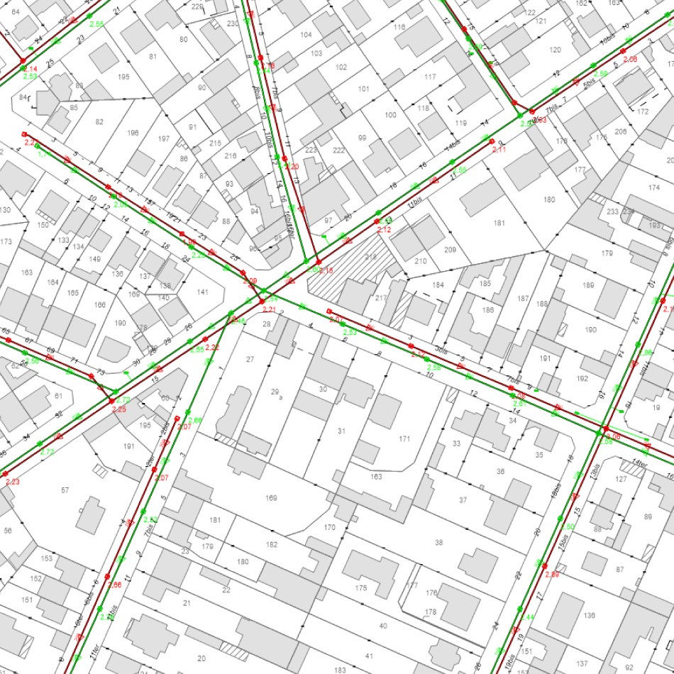
astradal offers a platform of spatial and modular applications that meets the needs of city management players as well as GIS professionals. astradal thus offers a wide range of software solutions on the web, equipped with spatial functions emphasizing the integration of geographical data, their processing, their visualization and their exploitation. Thanks to these solutions based on geospatial functionalities and astradal’s cartographic technology, companies can thus better exploit their data and analyze them, up to being part of a predictive approach (observation of weak signals, detection of trends).
The value given to the data by this technology is only made possible thanks to the astradal cartographic engine and its algorithm which allows the compression without loss of data and the visualization of a very large number of points in record time. Through its technical specifications, this engine addresses challenges well beyond the traditional fields of GIS and aims to meet the needs generated by the acceleration of smart city services, also with a strong dimension of interoperability: big data, cloud and speed of exchanges offered by the bouquet of astradal applications (cards for professions serving city management).
astradal business solutions and applications
The digital revolution has led to another revolution: that of the massification of data. Based on the explosion of social networks and web browsing, this trend will find new impetus in the exponential development of connected objects (autonomous cars… and lighting points, pipes, electricity networks, roads, etc. .) and more generally through the strengthening of the Smart City.
From this series of revolutions, questions arise around the exploitation of these data and in particular their visualization. Until today, the expression of this data was done through dashboards allowing to display series of calculations, graphs of results. Now, as localization becomes the queen of data, there is also an acute question of the management and visualization of mappable data… through applications.
At astradal, the card has established itself as the heart of astradal applications serving trades and industries:
- the acceleration of renewable energy projects and the “smartization” of networks are reinforced thanks to spatial analyses,
- the distribution of water, the collection of waste water or the routing of rainwater, are just as many networks that the cartographic performance makes it possible to monitor,
- the Internet of Things represents a challenge and an opportunity for city stakeholders, in order to reduce costs in areas such as waste management or lighting,
- spatial data accelerates decision-making by public actors to solve pressing environmental and land issues,
- the optimization of infrastructures is positioned as the key to the future of mobility,
- connected objects bring a new dimension of geographical intelligence to the management of equipment and infrastructures,
- real-time visualization facilitates field operations, in real time, on public facilities and private assets,
- spatial data enriches knowledge of real estate markets and facilitates asset management.

Smart grids

Water & utilities

Smart city

Land management

Mobility and roads

Connected objets

Public facilities

Real estate
Astradal maps at the service of geographic intelligence
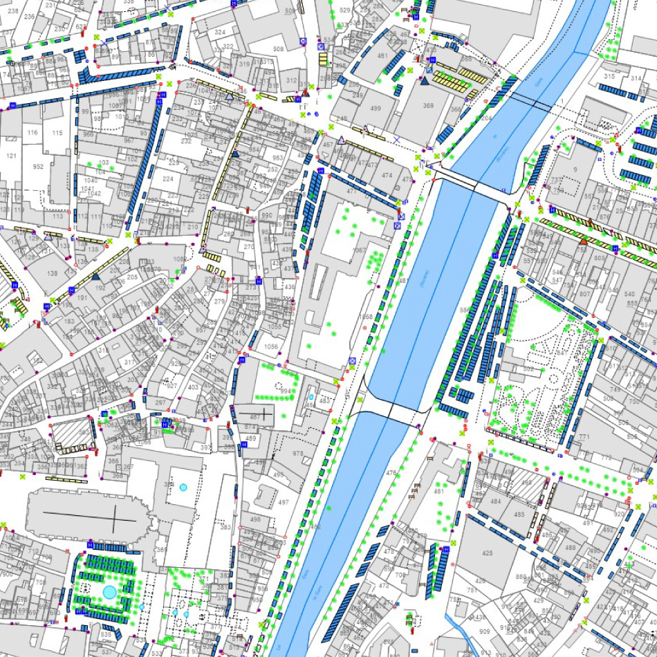
“Thick client”, our pro maps, accessible from a desktop, or even “thin client”, our light maps, accessible from a smartphone or tablet, are all environments that allow the display of our customers’ data and the processing of their data.
From nomadic technology, solution adapted to the terrain with ideal GPS location for centralized observation in real time, to the complete GIS solution for consultation, printing, construction, display, etc. thanks to a tiled display of vector and raster data, astradal offers its customers an innovative experience in the field of cartographic intelligence.
Otherwise called “location intelligence” in the Anglo-Saxon world, this approach is a cartographic visualization solution embedding a fully configurable topological construction (symbologies, attributes, links) at the service of the transformation of the actors of the city
Advice & training
Catalog

Tailor-made professional training
Public entities and businesses
Our educational team is ready to support you in your professional success with :
Trainers and recognized experts
A national and international mobility reference
A disability representative
An educational administration manager, a coach, a psychologist and other speakers from a European and international professional network.
Safety & security
Safety and security are all about mapping
For local authorities and businesses alike, networks, buildings, facilities and installations are, by their very nature, points of entry that can be vulnerable.
-
- It must be adapted to the area concerned and be educational (illustrations, checklists of good practice, simplified maps with landmarks, etc.).
- Remind people of the risks to which they are exposed, and the need for everyone to take responsibility for their own safety.
- Defines each risk briefly and locally.
- Use maps to measure safety issues.
astradal’s safety and security offer
-
-
It takes place in several stages:
1/ an audit to identify past and present heritage damage (damage to public property, vandalism, theft of materials, intrusion into public or private buildings, etc.), to identify the causes of this vulnerability (easy access, lack of security, malicious intent, etc.) and to list the possible solutions for dealing with them.
-
- Astradal offers an interactive platform for collecting and processing data from its customers
- astradal has the means and techniques to collect data on site to ensure their security
- astradal has the technical and cartographic capacity to provide “tailor-made” services according to the needs expressed and the applicable regulations.
2/ whatever the country, draw up a map of the sites concerned, highlighting what needs to be preserved and the entry or access points that need to be secured.
3/ make equipment available for 24/7 remote surveillance for periods corresponding to the needs expressed.
-
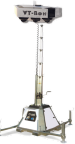
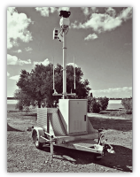
- Our autonomous, mobile and connected surveillance systems are based on effective meshing of the area to be monitored, combining deterrence, detection, video surveillance and alert equipment based on the latest innovations.
- Our mobile video surveillance towers, equipped with a tracking system and image analysis, are autonomous and connected, recording and alerting 24 hours a day, 7 days a week.
- They are equipped with autonomous 360° cameras and deterrent elements to signal to intruders that their presence has beeń detected.
- Our equipment is capable of continuously monitoring installations in 24-hour TAPE mode,
- Process images remotely in the event of a break-in
-
-
 |
 |
astradal’s global offer therefore enables public operators and private players alike to acquire tools to ensure optimised management of the security of their infrastructures and assets, and to develop consultancy and training services to ensure the sustainability of this optimisation approach.
astradal offers a global solution using all the technological resources and possibilities of AI, which makes it possible to cover an unlimited geographical area (municipalities, departments, regions, business parks, etc.), to secure the applicable regulations, to be part of a current sustainable development approach and to anticipate responses to future societal challenges in terms of safety.
This process is part of a current sustainable development approach aimed at anticipating responses to future societal challenges in terms of safety.
There are many references for these systems:

4/ training for local authority or company staff
astradal has teamed up with 2AF to offer tailor-made safety/security training courses.
This enables us to meet regulatory and insurance obligations. Our Qualiopi certification makes it easy to pay for these training courses.
-
- ERP accessibility
- Prevention and safety plan
- Preparing for the ERP safety commission visit
- How to protect your business (validated by APSAD)
- How to protect yourself against theft and burglary
- Preventing risks
- ERP fire regulations
- Fire safety for J type establishments (EPHAD)
- Fire safety in establishments governed by the Labor Code
- Communal safeguard plan
They can be accessed from the website : https://altius-aleph.catalogueformpro.com
Partners
Law firm
lex-squared.com
Strategy – Consulting – Certification
rseconseil.fr
Debate – train – inform
rse-responsables.com


Training – Conferences – symposiums, seminars
altius-aleph.catalogueformpro.com

Securing vulnerable sites
aleph-surveillance.com
Law firm
lex-squared.com
Strategy – Consulting – Certification
rseconseil.fr
Debate – train – inform
rse-responsables.com
Training – Conferences – symposiums, seminars
altius-aleph.catalogueformpro.com

Securing vulnerable sites
aleph-surveillance.com
Contact us
astradal is an innovative company based in Toulouse, benefiting from the local ecosystem and the dynamism of the Occitan economic basin, close to our partners, major R&D facilities and international clusters..
32 rue Riquet, 31000 TOULOUSE